Papua New Guinea at a glance: its flag, its capital Port Moresby, its population and where it sits on the world map. Plus a way to test yourself afterwards.
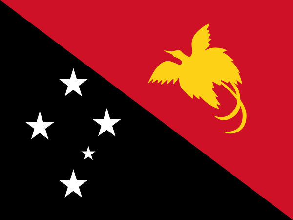
Adopted on 1 July 1971, while Papua New Guinea was still under Australian administration, the flag came out of a national design competition won by a fifteen-year-old, Susan Karike.
The diagonal splits the flag between red, bearing the country’s golden bird of paradise, and black, lit by the Southern Cross — the same constellation also found on the Australian and New Zealand flags, a nod to the shared night sky of the southern hemisphere.

One bordering country
So you know this country? Check that you know the other 192 too.
Data: Wikidata (CC0). Flags and map: Geo Nerd.
Are you sure you want to reset this game?