Côte d'Ivoire at a glance: its flag, its capital Yamoussoukro, its population and where it sits on the world map. Plus a way to test yourself afterwards.
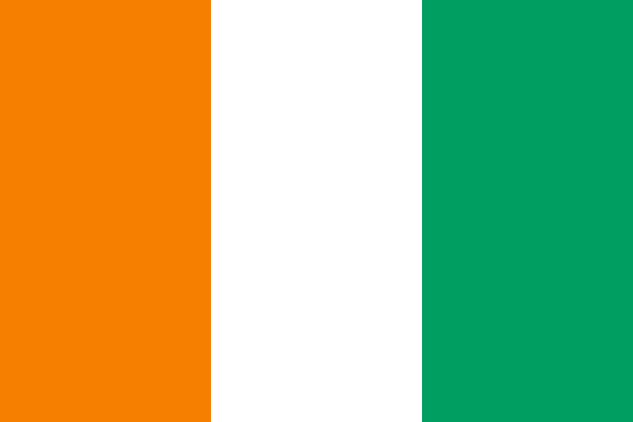
Adopted on 3 December 1959, ahead of independence in 1960, Côte d’Ivoire’s vertical orange, white and green tricolour has never changed since — it carries, in reverse order, the colours of the Irish flag.
Orange is said to stand for the northern savanna and the blood shed for independence, green for the southern forests and hope for the future, and white for the peace meant to unite the two regions.

5 bordering countries
So you know this country? Check that you know the other 192 too.
Data: Wikidata (CC0). Flags and map: Geo Nerd.
Are you sure you want to reset this game?